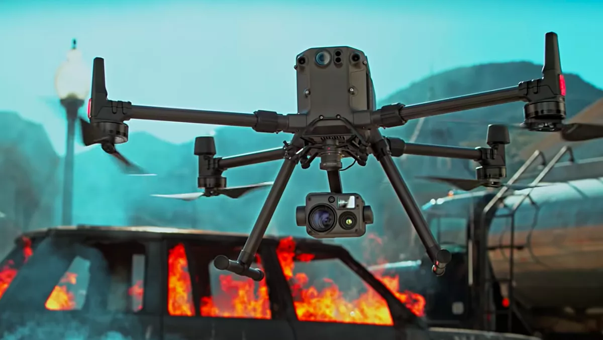
DJI releases state of the art commercial drone
Drone and aerial imaging specialist DJI has announced the Matrice 300 RTK (M300 RTK) commercial drone platform with the Zenmuse H20 Series hybrid, multi-sensor camera.
DJI engineered this all-in-one solution for precise aerial inspections and data collection missions.
"With the M300 RTK flying platform and the Zenmuse H20 camera series, we are providing a safer and smarter solution to our enterprise customers," says DJI corporate strategy director Christina Zhang.
"This solution sets an entirely new standard for industrial UAV solutions, significantly enhancing operations across public safety, law enforcement, energy, surveying and mapping as well as critical infrastructure inspections.
The M300 RTK integrates modern aviation features, AI capabilities, 6 Directional Sensing and Positioning System, a UAV health management system, and a 55 minutes' flight time with optimal conditions.
Alongside AES-256 encryption and an IP45 weather-resistant enclosure, the drone platform comes built-in with an OcuSync Enterprise transmission system, which provides a triple-channel 1080p video transmission signal reaching up to 15 km.
The M300 RTK can support up to 3 payloads simultaneously and has a maximum payload capacity of up to 2.7 kg.
Combined, the M300 RTK and Zenmuse H20 Series solution offers users two intelligent ways to collect data:
Smart Pin - Track – Intelligent functions that enhance the synchronisation of aerial intelligence in coordinated missions.
It includes PinPoint, a function that allows users to mark the subject of interest and instantly share the precise location data to a second operator or if necessary to ground teams via DJI FlightHub; and Smart Track, which allows users to automatically detect and track a moving object, even at extreme distances, while synchronising the subject's dynamic location in real-time.
Smart Inspection – A new set of features developed to optimise routine data collection missions such as power lines, railway and oil and gas inspections.
It consists of Live Mission Recording for recording sample automated missions in real-time; AI-Spot Check which enables data collection from exactly the same location every time, greatly improving the accuracy of automated missions.
After photos from a sample waypoint inspection mission have been recorded, operators are able to mark the subject of interest. During subsequent automated flight missions, AI algorithms perform a comparison between the marked subject and current live view, correcting the camera orientation accordingly to deliver accurate and consistent results; and Waypoints 2.0 – an improved mission planning system offering up to 65,535 waypoints while supporting an array of consecutive actions, 3rd party payloads, and more.
The M300 RTK features a Primary Flight Display (PFD) that merges real-time flight and navigation data into one integrated display.
Besides standard telemetry data like altitude and speed, the M300 RTK PFD provides obstacle data for visualising nearby obstacles during flight, enabling pilots to adjust flight trajectory if needed. These enhancements allow users to keep track of the aircraft while further enhancing the pilot's situational awareness.
New to DJI's commercial drone platforms and exclusive to the M300 RTK, is Advanced Dual Operator Mode – multi-pilot control protocols.
When controlled by two pilots it gives each pilot equal access to gain flight control priority, the transfer of which is displayed by a series of icons on the DJI Smart Controller Enterprise.
If one pilot becomes compromised or their controller loses battery or connection, the other pilot gains full control over the M300 RTK and its payloads.
Additionally, when training new pilots, the teacher/main pilot can safely take over flight control – if and whenever necessary.
As with modern-day jetliners, the M300 RTK offers an integrated UAV Health Management System (UHMS) to optimise fleet maintenance.
It records the aircraft's flight data throughout its entire lifecycle, and utilises the drone's hardware and software systems to understand current aircraft performance and determine when it should be serviced.
Taking advantage of this new system, users can get a quick overview of all critical aircraft systems, manage firmware updates across an entire fleet, track pilot hours and review flight missions.
To fit the new standards set by the M300 RTK, DJI has unveiled completely new camera payloads that radically improve mission efficiency.
The Zenmuse H20 series offers DJI's Hybrid multi-sensor solution, allowing to capture any kind of images for industrial applications and public safety missions where efficient time management and immediate access to multiple layers of visions are paramount.
The H20 Series is IP44 rated which protects enclosures from splashes of water from any direction.
The H20 series comes in two versions: The H20, a triple sensor with a 20MP, 23x Hybrid Optical Zoom Camera, a 12MP Wide Camera, and a Laser Range Finder covering distances from 3m-1200m; and the H20T, a quad sensor which adds a 640x512 Radiometric Thermal Camera, allowing operators to see what is invisible to the human eye thanks to high thermal sensitivity a 30 fps video definition.
To enable pilots to operate so many sensors at once, the new user interface lets pilots quickly switch between cameras and simplifies the process of zooming in and out by letting pilots preview the zoom FOV on top of the wide-angle or thermal camera footage.
The H20 series allows users to smoothly switch between wide, zoom or thermal cameras.
High-Res Grid Photo captures in one snap detailed imagery of defined subjects with the help of a custom grid. The images can be stored for later detailed inspection.
With One-Click Capture, users can capture videos or photos of up to three cameras simultaneously without having to manually switch between camera views or repeat a mission.
Night Scene allows for clearer visibility when lighting conditions are not optimal.

